Breathe Smart.
Live Safe
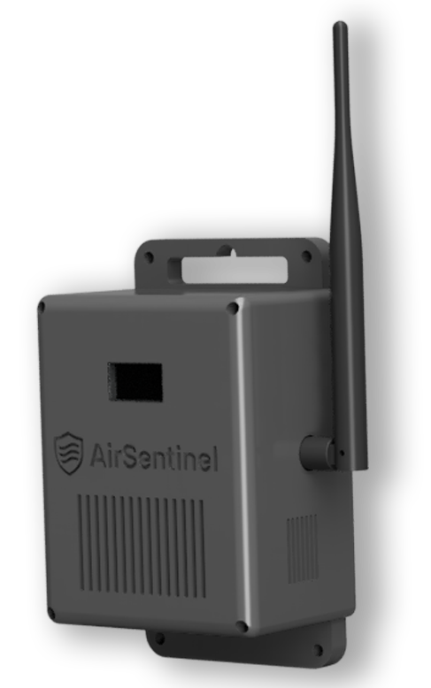
Air Sentinel helps cities, schools, and communities breathe easier. It watches the air around you — day and night — detecting pollution, weather changes, and fire risks in real-time. With long-range coverage and automatic alerts, it keeps people safe without needing constant attention.
 Clean Air Intelligence That Works Quietly


Companies of all sizes
trust Resend to deliver
their most important emails.
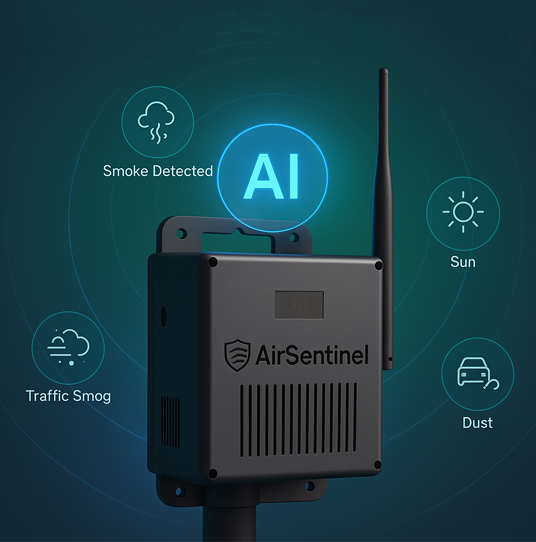
Smart AI That Thinks for You
Detects problems before they happen
Air Sentinel uses AI to spot early signs of pollution, smoke, or unusual activity — and warns you instantly.
Knows the difference between traffic and trouble
Its smart brain learns your environment — so it can tell if air changes are from rush hour or something risky.
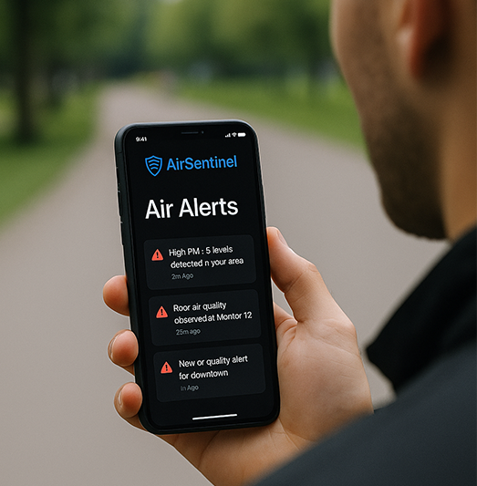
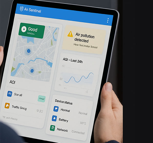
Air Quality at Your Fingertips
Use the Air Sentinel mobile dashboard to check live air quality, battery levels, and alerts — all from your phone. Whether you're overseeing one device or a hundred, you're always in control.
- See air quality by zone in real-time
- Get notified about pollution, smoke, or battery warnings
- Adjust settings and power behavior remotely
Air Sentinel simplifies
Clean air deployment
5M+
Air Quality Readings Collected
Across smart cities, schools, and remote sites.
90+ Days
Average Battery Runtime
With solar-assisted operation in the field.
98.7%
AI Alert Accuracy
Smart detection of smoke, pollution, and gas anomalies.
100+
Deployments Worldwide
Installed in buildings, parks, campuses, and street zones.
Real-Time Dashboards
Whether you're managing a single site or an entire city, AirSentinel's powerful dashboards put everything you need at your fingertips. Monitor air quality in real time, track historical trends, check device status, and receive instant alerts — all from a unified, intuitive interface tailored for government, enterprise, and environmental teams.
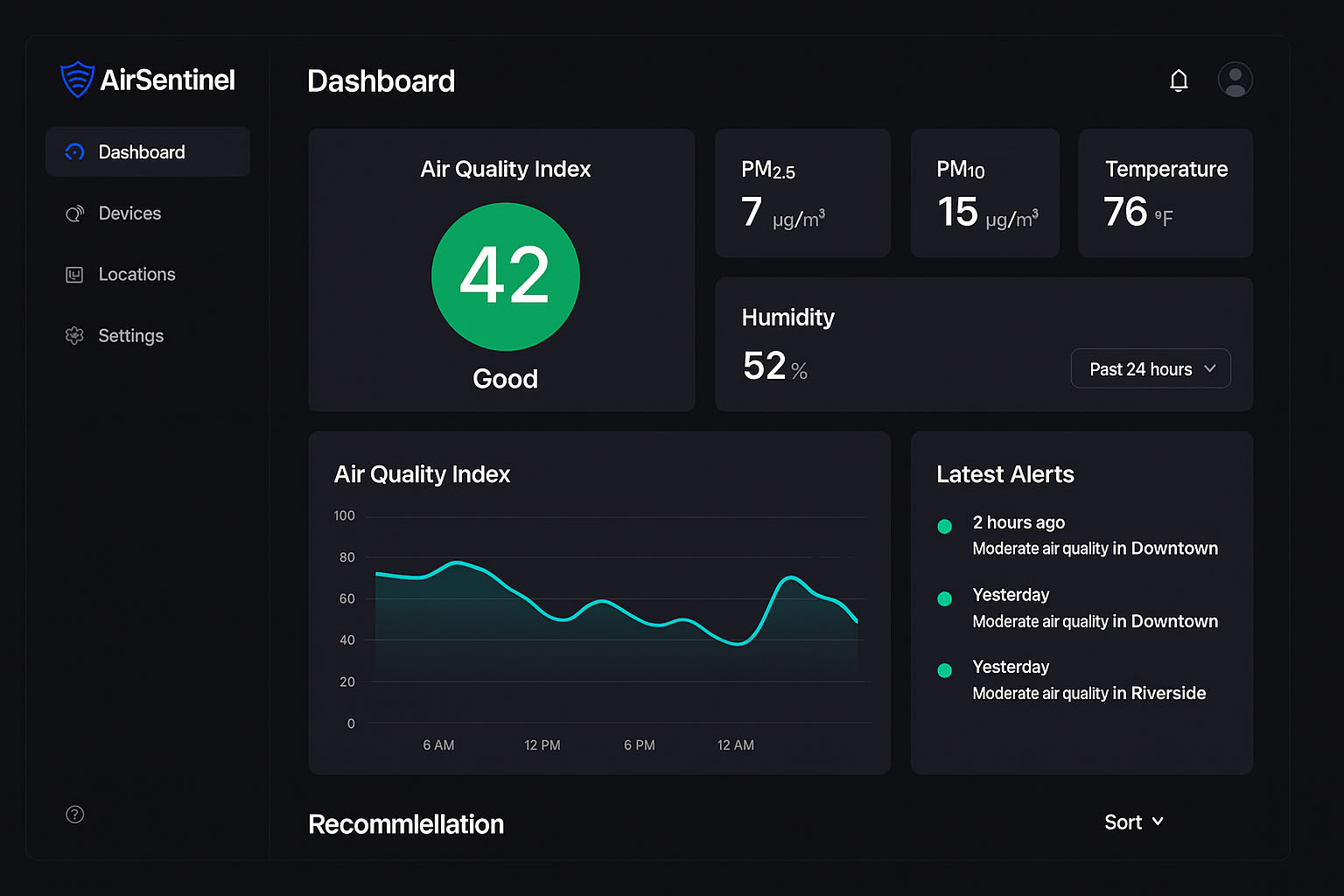
Command Center: Real-Time Environmental Overview
The AirSentinel home dashboard gives you a city-wide snapshot of air quality, key environmental metrics, and active alerts — all in one place. Designed for rapid decision-making and public safety monitoring.
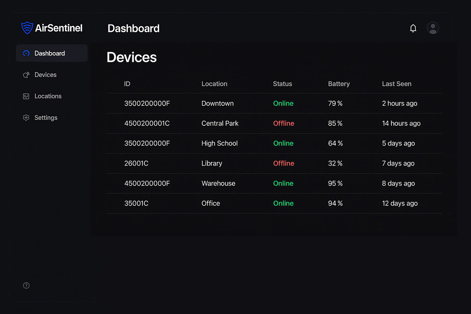
All Devices, One View
Easily manage and monitor every AirSentinel device across your network. View device IDs, locations, status, connectivity, battery health, and last-seen activity — in a centralized, filterable list.
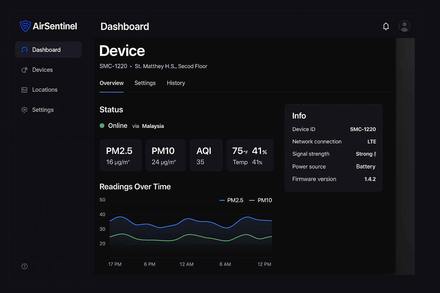
Live Data From the Field
Drill down into a specific device’s performance, air quality readings, uptime, and power metrics. Get real-time updates and diagnostics to maintain operational excellence across every site.
Easily integrates with platforms you already use
Cloud Sync
Push real-time air quality data to your preferred cloud — AWS, Azure, or custom platforms.
Smart City Dashboard
Integrate directly with public dashboards and municipal control rooms in just a few steps.
Alert Automation
Trigger SMS, email, or speaker alerts using built-in AI-based thresholds and warning levels.
Secure API
Access encrypted sensor data via authenticated endpoints for private or public reporting.
SDK & CLI Tools
Use developer-friendly command-line tools and SDKs to deploy or debug any device quickly.
GIS Mapping Export
Export heatmaps, zones, and alerts to ArcGIS, QGIS, or Google Maps via KML and GeoJSON.
Frequently asked questions
Curious about what Air Sentinel can do? We’ve answered the most common questions to help you understand how it keeps your air clean and your data accessible.
Schedule a Meeting to Discuss Deployment & Pricing
Whether you're planning a city-wide rollout or a single-site deployment, we're here to help. Book a free session with our team to explore pricing, technical specs, integration options, and everything you need to launch Air Sentinel with confidence.
Prefer to talk directly? Feel free to get in touch with us via email or phone — we're happy to answer your questions, walk you through options, or help you get started with Air Sentinel.
